
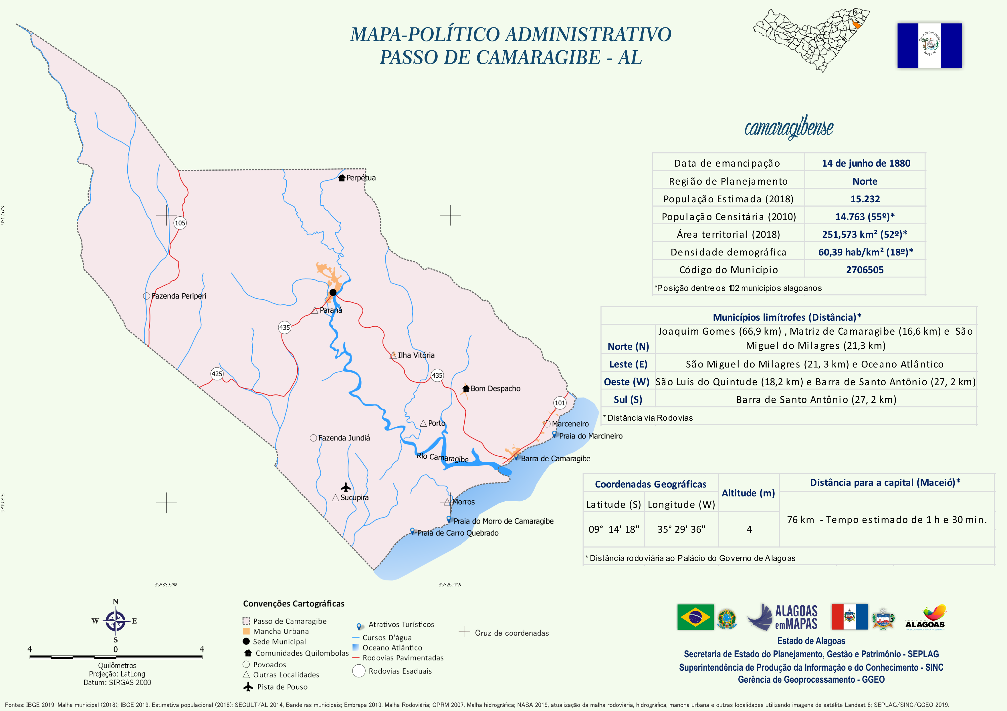
Mapa Político-Administrativo de Passo de ...
Mapa Político-Administrativo de Passo de Camaragibe no formato PNG.
Zusätzliche Informationen
| Feld | Wert |
|---|---|
| Daten wurden zuletzt aktualisiert | 16. Dezember 2020 |
| Metadaten zuletzt aktualisiert | 16. Dezember 2020 |
| Erstellt | 16. Dezember 2020 |
| Format | PNG |
| Lizenz | Creative Commons Atribuição |
| Has views | True |
| Id | beaef9d3-642e-4f60-a9d8-cc6b5506a02e |
| Mimetype | image/png |
| On same domain | True |
| Package id | be51cbbc-3abf-4393-86ef-07f0654e03a2 |
| Revision id | 7e4242a7-9067-4f1e-bf5f-b5ff9c74879a |
| Size | 1,2 MiB |
| State | active |
| Url type | upload |