
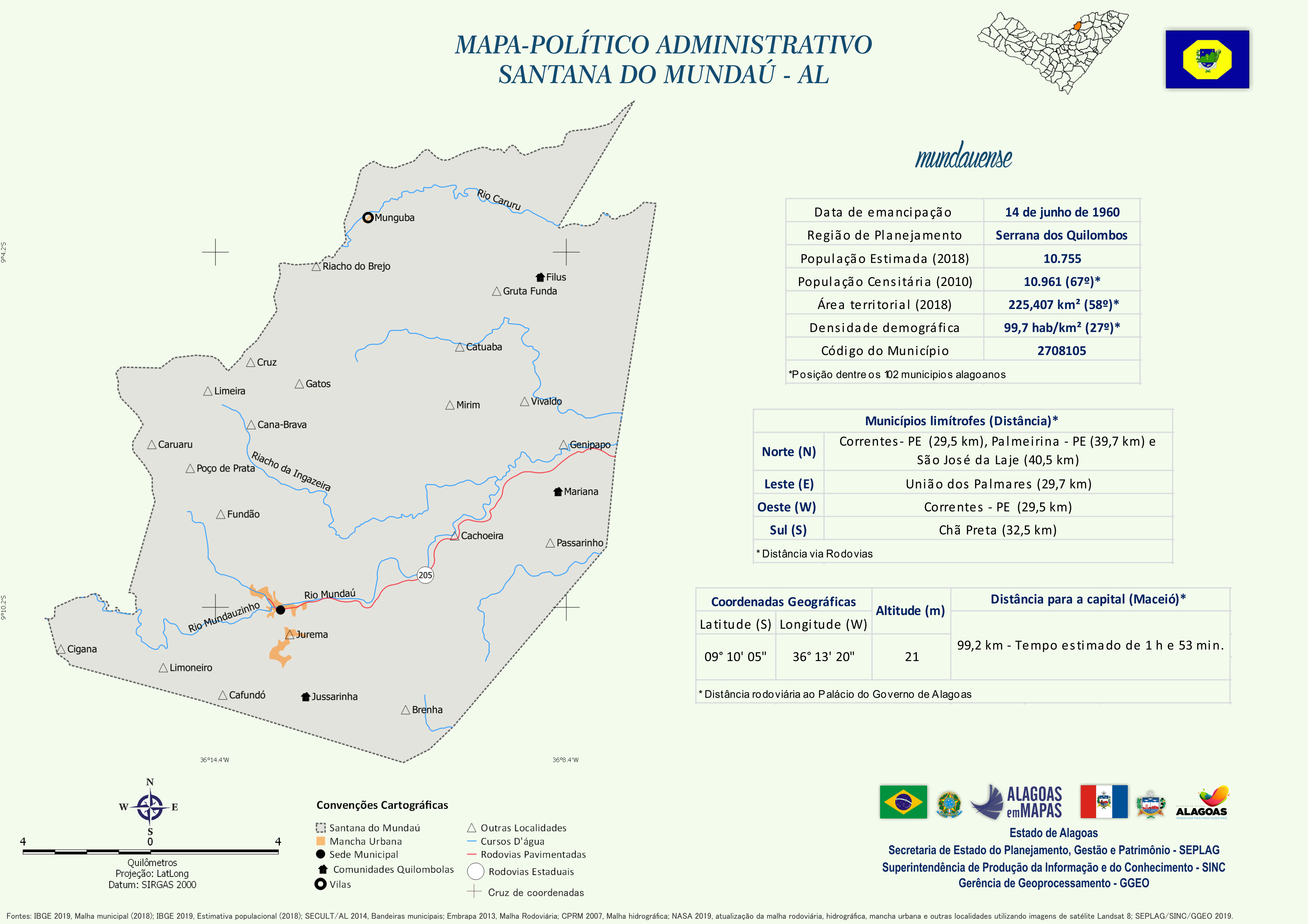
Mapa Político-Administrativo de Santana do Mundaú
Mapa Político-Administrativo de Santana do Mundaú formato PNG.
Zusätzliche Informationen
| Feld | Wert |
|---|---|
| Daten wurden zuletzt aktualisiert | 16. Dezember 2020 |
| Metadaten zuletzt aktualisiert | 16. Dezember 2020 |
| Erstellt | 16. Dezember 2020 |
| Format | PNG |
| Lizenz | Creative Commons Atribuição |
| Has views | True |
| Id | f0b0ffa2-ab60-466a-b4df-827ffef0a96e |
| Mimetype | image/png |
| On same domain | True |
| Package id | 5e8fe5cc-5244-49ec-8716-c6c87f3bd637 |
| Revision id | f7a7fd12-9159-451f-b308-a29a59a96f19 |
| Size | 1,1 MiB |
| State | active |
| Url type | upload |