
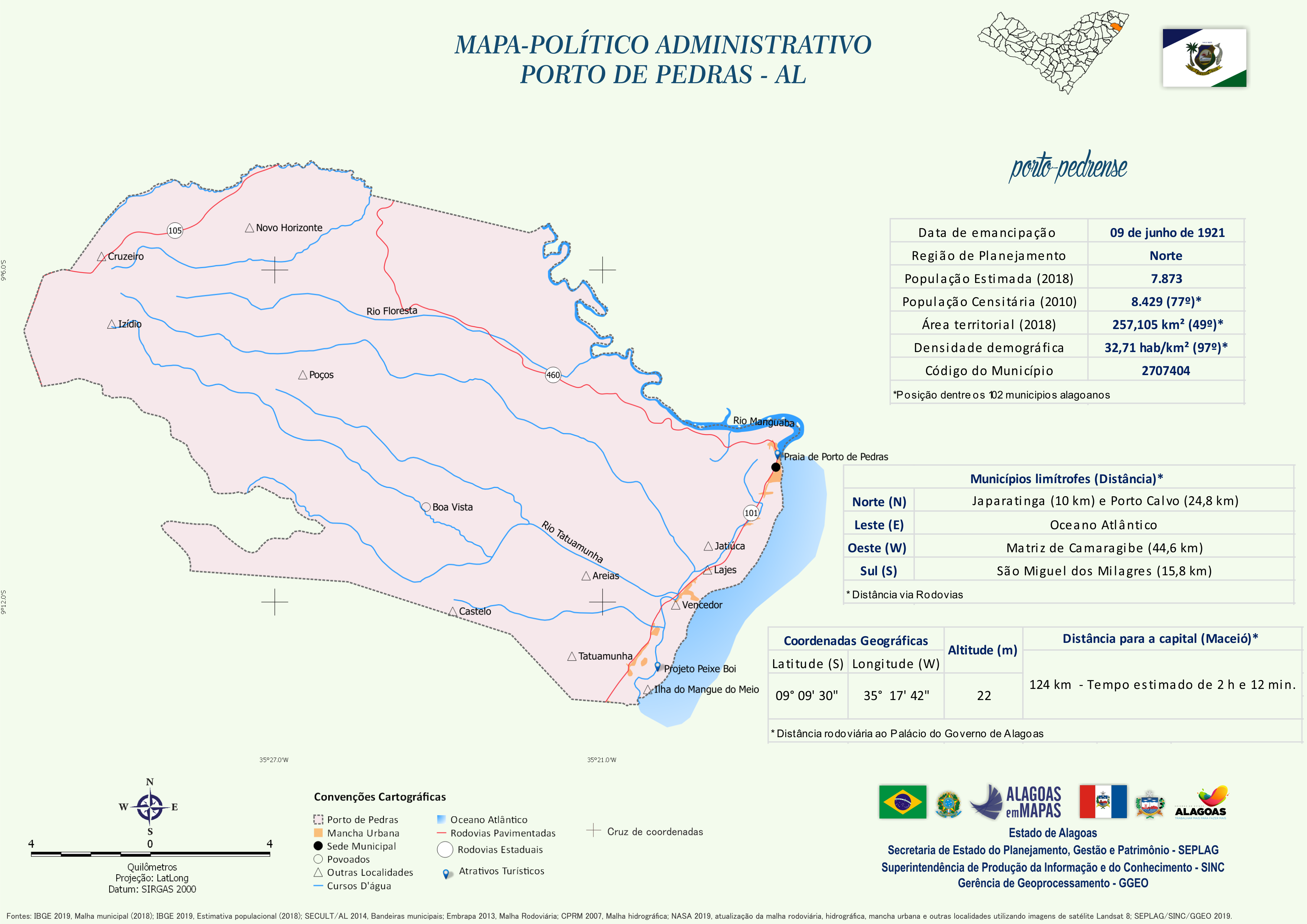
Mapa Político-Administrativo de Porto de Pedras
Mapa Político-Administrativo de Porto de Pedras no formato PNG.
Additional Information
| Field | Value |
|---|---|
| Data last updated | December 9, 2020 |
| Metadata last updated | December 9, 2020 |
| Created | December 9, 2020 |
| Format | PNG |
| لایسنس | Creative Commons Atribuição |
| Has views | True |
| Id | 128b0640-15f6-4be9-9797-dc7d8784c566 |
| Mimetype | image/png |
| On same domain | True |
| Package id | 2e160440-46b6-45d5-ac8a-2968ab480a44 |
| Revision id | 219bbf0b-0b47-4bfc-ba28-93989cd0476e |
| Size | 1.2 MiB |
| State | active |
| Url type | upload |