
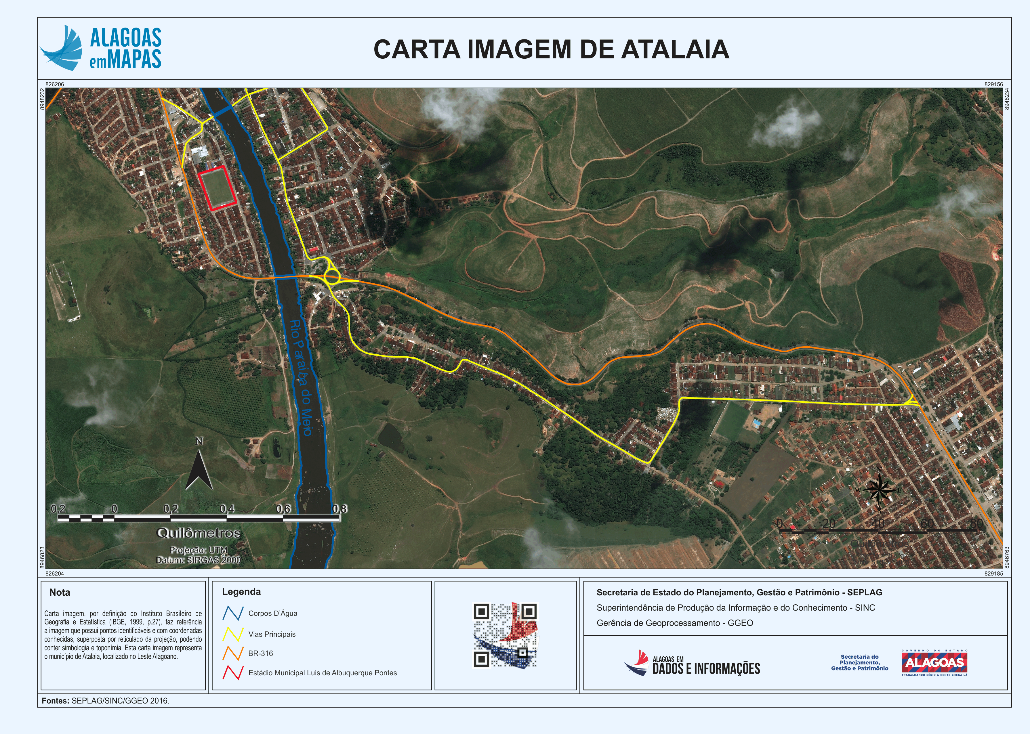
Carta Imagem de Atalaia
Carta imagem, por definição do Instituto Brasileiro de Geografia e Estatística (IBGE, 1999, p.27), faz referência a imagem que possui pontos identificáveis e com coordenadas conhecidas, superposta por reticulado da projeção, podendo conter simbologia e toponímia. Esta carta imagem representa o município de Atalaia, localizado no Leste Alagoano.
Нэмэлт мэдээлэл
| Талбар | Утга |
|---|---|
| Өгөгдлийн сүүлийн шинэчлэл | 2020 12-р сар 9 |
| Мета өгөгдөлийн сүүлийн шинэчлэл | 2020 12-р сар 9 |
| Үүссэн | 2020 12-р сар 9 |
| Хэлбэр | PNG |
| Ашиглах зөвшөөрөл | Creative Commons Atribuição |
| Has views | True |
| Id | e30e243c-38ce-47e8-be87-abaf837406c0 |
| Mimetype | image/png |
| On same domain | True |
| Package id | 967a2db5-3f09-45f1-930e-bec1caeda164 |
| Position | 1 |
| Revision id | c0633666-a6b7-428c-b4c1-14a15b1ccb1d |
| Size | 4.1 мегабайт |
| State | active |
| Url type | upload |