
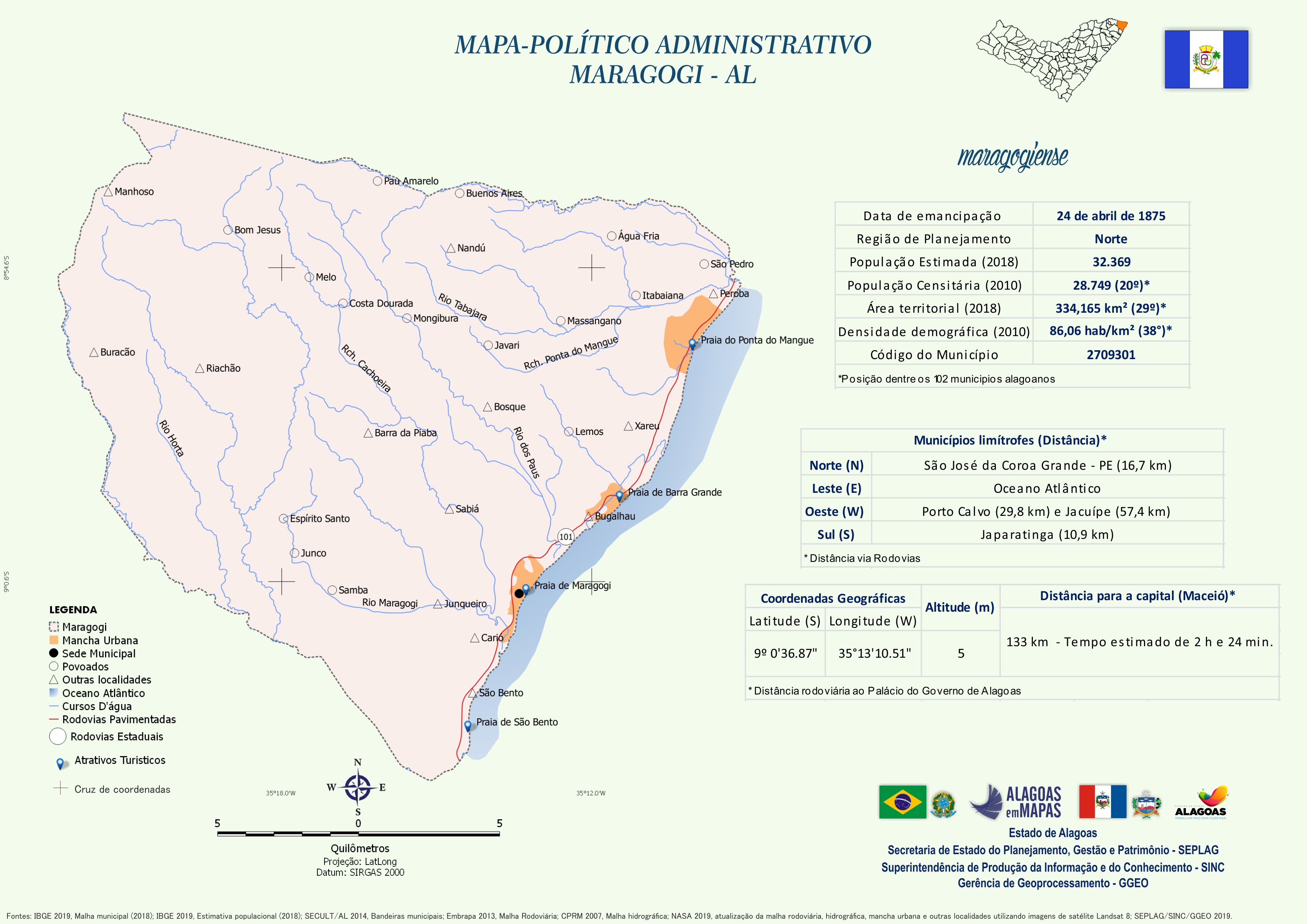
Mapa Político-Administrativo de Maragogi
Mapa Político-Administrativo de Maragogi no formato PNG.
Zusätzliche Informationen
| Feld | Wert |
|---|---|
| Daten wurden zuletzt aktualisiert | 14. Dezember 2020 |
| Metadaten zuletzt aktualisiert | 14. Dezember 2020 |
| Erstellt | 14. Dezember 2020 |
| Format | PNG |
| Lizenz | Creative Commons Atribuição |
| Has views | True |
| Id | 01673f0c-0283-4d41-a13f-839d20a7a48d |
| Mimetype | image/png |
| On same domain | True |
| Package id | 427bc142-e36c-400a-9547-7e81bdb7b8fa |
| Revision id | 8e1ef38c-0f9f-4a50-b07f-cab6702e85a2 |
| Size | 1,3 MiB |
| State | active |
| Url type | upload |