
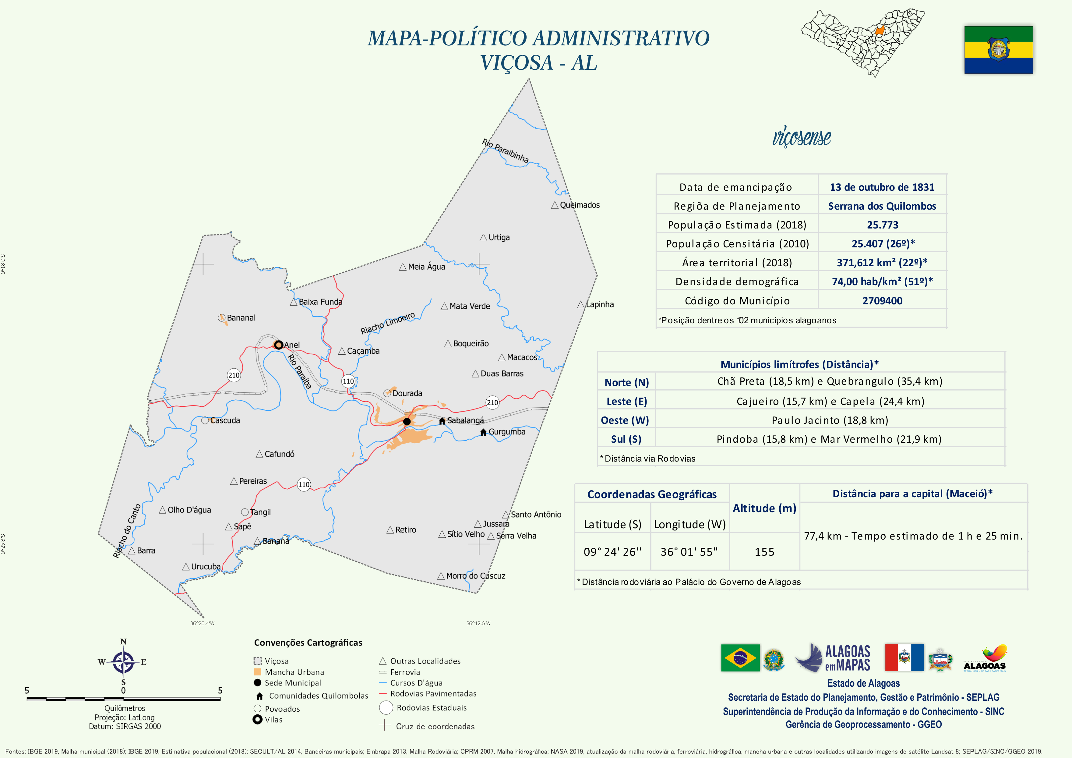
Mapa Político-Administrativo de Viçosa
Mapa Político-Administrativo de Viçosa no formato PNG.
Zusätzliche Informationen
| Feld | Wert |
|---|---|
| Daten wurden zuletzt aktualisiert | 22. Dezember 2020 |
| Metadaten zuletzt aktualisiert | 22. Dezember 2020 |
| Erstellt | 22. Dezember 2020 |
| Format | PNG |
| Lizenz | Creative Commons Atribuição |
| Has views | True |
| Id | 31024182-6ca2-4d70-8be8-e05dd5ce394e |
| Mimetype | image/png |
| On same domain | True |
| Package id | 9a7116f2-e298-4eb4-bff5-380148ea64fa |
| Revision id | 0fdb614b-8f66-471f-a3aa-c057affc3abc |
| Size | 1,1 MiB |
| State | active |
| Url type | upload |