
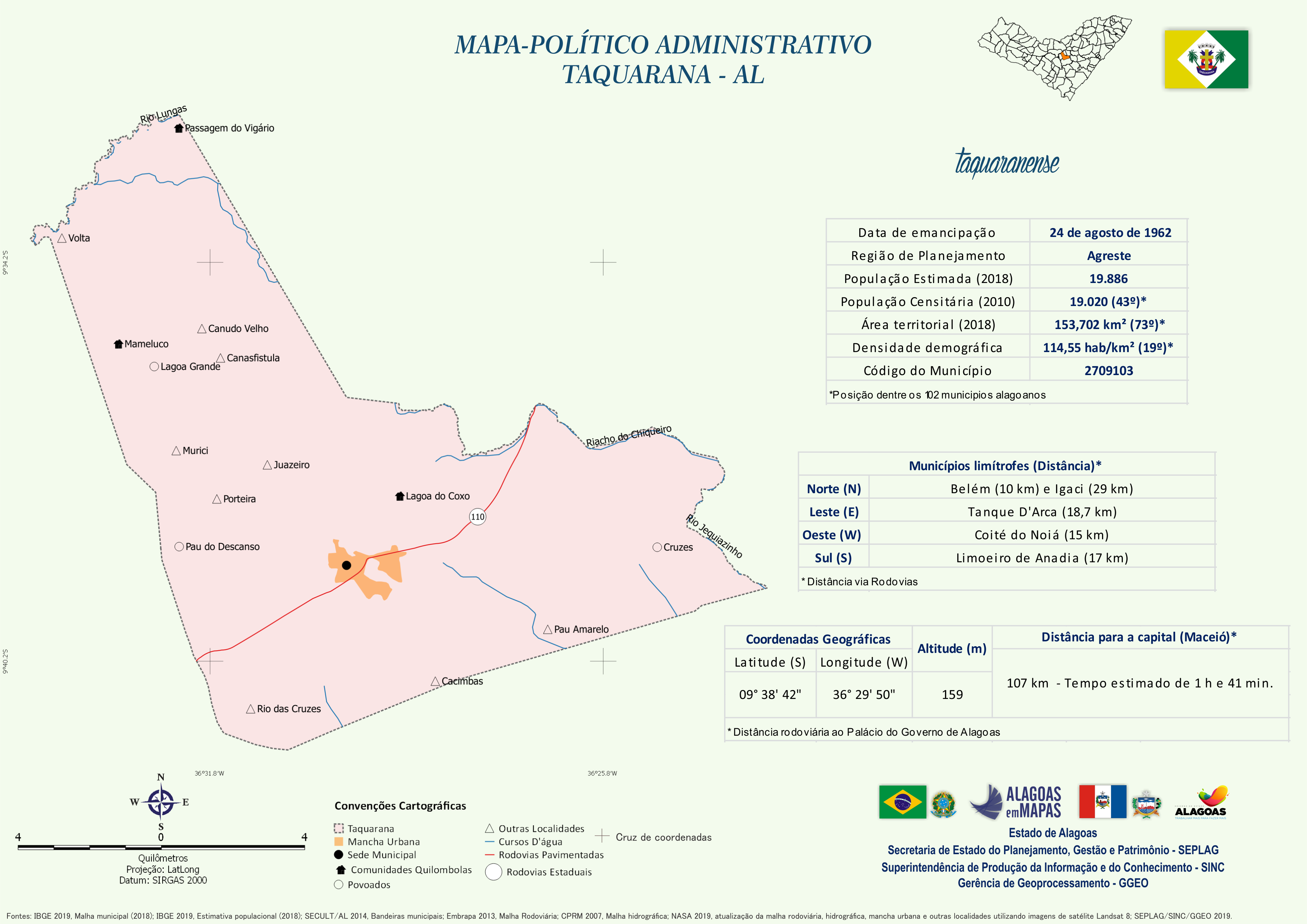
Mapa Político-Administrativo de Taquarana
Mapa Político-Administrativo de Taquarana no formato PNG.
Dodatkowe informacje
| Pole | Wartość |
|---|---|
| Data last updated | January 4, 2021 |
| Metadata last updated | January 4, 2021 |
| Created | January 4, 2021 |
| Format | PNG |
| Licencja | Creative Commons Atribuição |
| Has views | True |
| Id | a66f9d7c-5f88-4cc7-ac27-871f2f805d15 |
| Mimetype | image/png |
| On same domain | True |
| Package id | 1dfa10cc-7322-40cc-a550-bf5cc496b328 |
| Revision id | e89d322c-e15f-475d-a2e5-cbbe85b1e4f5 |
| Size | 1 MiB |
| State | active |
| Url type | upload |