
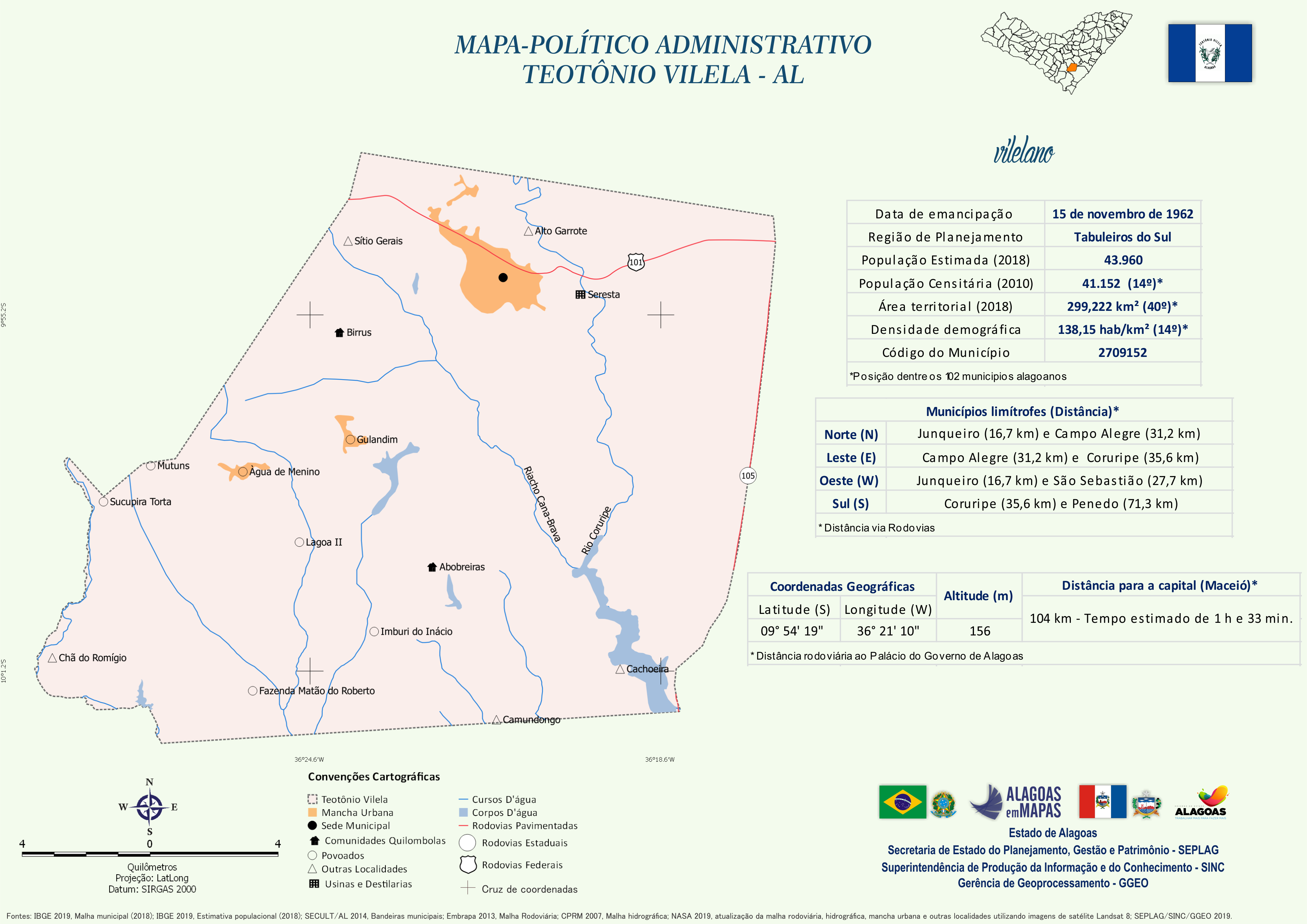
Mapa Político-Administrativo de Teotônio Vilela
Mapa Político-Administrativo de Teotônio Vilela no formato PNG.
Doplňujúce informácie
| Pole | Hodnota |
|---|---|
| Data last updated | 14 December, 2020 |
| Metadata last updated | 14 December, 2020 |
| Vytvorené | 14 December, 2020 |
| Formát | PNG |
| Licencia | Creative Commons Atribuição |
| Has views | True |
| Id | 43f699b0-d2f1-4777-990d-832174afa505 |
| Mimetype | image/png |
| On same domain | True |
| Package id | e67a1cf9-207c-4b52-beb5-bcedbe5cb669 |
| Revision id | e3cd0f35-4f23-41bd-9f63-8cc7352ae359 |
| Size | 1,1 MB |
| State | active |
| Url type | upload |